Kalkwand Umrundung

Mountain Hike recommended route

Kalkwand Umrundung

Mountain Hike · Hall-Wattens
Logo Tourismusverband Region Hall-Wattens
Responsible for this content
Tourismusverband Region Hall-Wattens Verified partner  Explorers Choice 
  • Lizumer Hütte
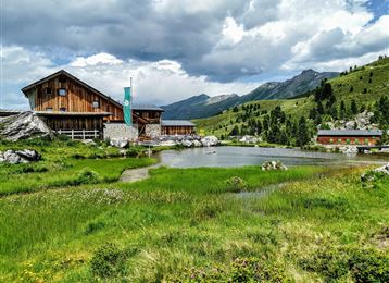
    Lizumer Hütte
    Photo: Anne W., Tourismusverband Region Hall-Wattens
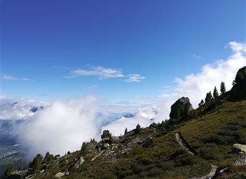
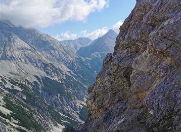
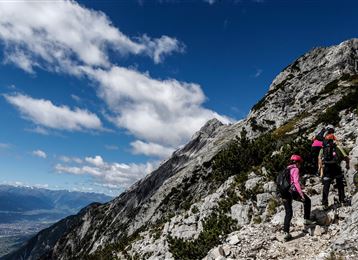
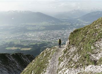
Impressive hike from the Lizumer Hütte over the green Tuxer.
difficult
Distance 19.6 km
6:30 h
1,194 m
1,802 m
2,516 m
1,410 m
 

Lager Walchen (Hüttentaxi) - Lizumer Hütte - Junsjoch (2484 m) - Junsbergalm (1984 m)- Ramsjoch - Nasse Tux Torseen - Torjoch (2386 m) - Lizumer Hütte - Lizum - Lager Walchen

Profile picture of Anne W.
Author
Anne W. 
Update: September 24, 2021
Difficulty
difficult
Technique
Stamina
Experience
Landscape
Highest point
2,516 m
Lowest point
1,410 m
Best time of year
Jan
Feb
Mar
Apr
May
Jun
Jul
Aug
Sep
Oct
Nov
Dec

Track types

Asphalt 3.68%Dirt road 6.33%Forested/wild trail 11.34%Path 78.64%
Asphalt
0.7 km
Dirt road
1.2 km
Forested/wild trail
2.2 km
Path
15.4 km
Show elevation profile

Rest stops

Lizumer Hütte

Safety information

Attention danger of falling rocks! Please inform yourself about the current situation before starting the tour!

Start

Lizumer Hütte (2,017 m)
Coordinates:
DD
47.166585, 11.642065
DMS
47°09'59.7"N 11°38'31.4"E
UTM
32T 700234 5227063
w3w 
///webs.pleasantly.flaky

Destination

Lizumer Hütte

Turn-by-turn directions

From the Lizumer Hütte on the Junssteig, up to the Junsjoch. Down through the Junsgrube into the Tux valley. We always keep in the direction of "Stoankasern"/Junsalm-Hochleger. A few metres before the Hochleger, turnoff to the left to the Ramsjoch and Torsee.

At the "Zilljöchl", turn left up a few steeper serpentines to the highest point of the tour, the Ramsjoch at 2508 m with great views!

From the Ramsjoch, short serpentines down into the "Kessel" to the beautiful Tor lakes at the Nasse-Tuxeralm. From there the trail climbs up past the Torspitze, 2663 m and Grauen Wand, 2594 m to the Torjoch, 2386 m.

From the Torjoch, the trail leads to a pleasant path down to the starting point, the Lizumer Hütte.


Public transport

Mit dem Hüttentaxi zum Lager Walchen

By road

Wattens - Wattental - Lager Walchen

Parking

Lager Walchen

Coordinates

DD
47.166585, 11.642065
DMS
47°09'59.7"N 11°38'31.4"E
UTM
32T 700234 5227063
w3w 
///webs.pleasantly.flaky
Arrival by train, car, foot or bike

Similar routes nearby

  • Lizumer Reib`n Rundtour
  • Wattental - Möstal - Lizumer Mountain Hut
  • Hippoldspitze
  • Map / Geier
    Geier
  • Hirzer
 These suggestions were generated by our system
Difficulty
difficult
Distance
19.6 km
Duration
6:30 h
Ascent
1,194 m
Descent
1,802 m
Highest point
2,516 m
Lowest point
1,410 m
Round trip Scenic Refreshment stops available Insider tip

Statistics

  • Content
  • Show images Hide images
Features
Maps and trails
  • 1 Waypoints
  • 1 Waypoints
Distance  km
Duration : h
Ascent  m
Descent  m
Highest point  m
Lowest point  m
Push the arrows to change the view

Please wait

Accommodation is searched

Please be patient for a little more time

All data will be loaded in an instant