Wildangerspitze

Mountain Hike recommended route

Wildangerspitze

Mountain Hike · Hall-Wattens
Logo Tourismusverband Region Hall-Wattens
Responsible for this content
Tourismusverband Region Hall-Wattens Verified partner  Explorers Choice 
  • Wildangerspitze
    Wildangerspitze
    Photo: Anne W., Tourismusverband Region Hall-Wattens
Hiking tour to the summit of the Wildangerspitze
moderate
Distance 15 km
7:00 h
1,504 m
1,344 m
2,131 m
627 m
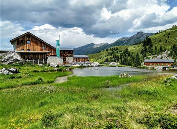
This mountain tour leads you up to the Wildangerspitze. On the way back you can stop at the Thaurer Alm for Tyrolean specialities.

Author’s recommendation

For experienced hikers expandable to the Lattenspitze
Profile picture of Anne W.
Author
Anne W. 
Update: May 23, 2023
Difficulty
moderate
Technique
Stamina
Experience
Landscape
Highest point
Wildangerspitze, 2,131 m
Lowest point
627 m
Best time of year
Jan
Feb
Mar
Apr
May
Jun
Jul
Aug
Sep
Oct
Nov
Dec
Cardinal direction
NESW

Track types

Asphalt 19.87%Dirt road 12.08%Forested/wild trail 9.33%Path 58.46%Road 0.23%
Asphalt
3 km
Dirt road
1.8 km
Forested/wild trail
1.4 km
Path
8.8 km
Road
0 km
Show elevation profile

Rest stops

Romediwirt
Thaurer Alm
St. Magdalena

Start

Thaur (626 m)
Coordinates:
DD
47.293716, 11.471860
DMS
47°17'37.4"N 11°28'18.7"E
UTM
32T 686887 5240767
w3w 
///nullify.regrettably.floodlit

Destination

Thaur/ Halltal Parkplatz

Turn-by-turn directions

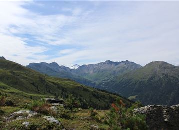
From the village Thaur we follow the forest road or the path up to the Thaurer Alm and further towards the so called Törl. Following the meadows up to the Törl. Once at the top of the saddle between Thaurer Zunterkopf and Wildangerspitze, you have a wonderful view to the Bettelwurfmassif and down into the Halltal valley.

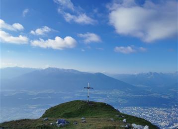
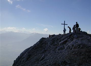
Continue north up the path towards Wildangerspitze/Lattenspitze. You get into a mountain pine-covered area, which clears up at the end. Crossing a grassy southern mountainside and following unmarked northwards  footprints towards the ridge edge. Here is the "summit cross" of the Wildanger. The possible route for  experienced hikers can be made out here and continues to the Lattenspitze. However, this path also has exposed passages.

Today we do not continue, but return the same way back to Törl. After a stop at the Thaurer Alm, we continue down to Thaur.

Public transport

Public-transport-friendly

Bus 501/502/503 -> Thaur Mitte

By road

Parkplatz Thaurer Alm

Parking

Parkplatz Thaurer Alm

Coordinates

DD
47.293716, 11.471860
DMS
47°17'37.4"N 11°28'18.7"E
UTM
32T 686887 5240767
w3w 
///nullify.regrettably.floodlit
Arrival by train, car, foot or bike

Similar routes nearby

  • Lippenkopf
  • Kreuzjöchl - ein unscheinbarer Gipfel im Karwendel
  • Über die Zunterköpfe zur Kaisersäule
  • From the Halltal to the Bettelwurf Mountain Hut
  • Through the Halltal to the peak of the Bettelwurf
 These suggestions were generated by our system
Difficulty
moderate
Distance
15 km
Duration
7:00 h
Ascent
1,504 m
Descent
1,344 m
Highest point
2,131 m
Lowest point
627 m
Public-transport-friendly Round trip Scenic Refreshment stops available Summit route Insider tip

Statistics

  • Content
  • Show images Hide images
Features
Maps and trails
  • 3 Waypoints
  • 3 Waypoints
Distance  km
Duration : h
Ascent  m
Descent  m
Highest point  m
Lowest point  m
Push the arrows to change the view

Please wait

Accommodation is searched

Please be patient for a little more time

All data will be loaded in an instant