Via Ferrata Absam

Via Ferrata recommended route

Via Ferrata Absam

Via Ferrata · Hall-Wattens
Logo Tourismusverband Region Hall-Wattens
Responsible for this content
Tourismusverband Region Hall-Wattens Verified partner  Explorers Choice 
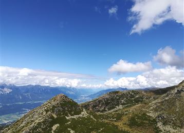
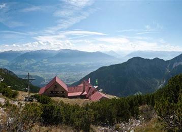
  • Blick in das Halltal
    Blick in das Halltal
    Photo: Hall Wattens, Tourismusverband Region Hall-Wattens
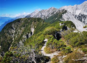
Challenging but stunning views at the side facing the sun. The Bettelwurf hut at the end of this Via Ferrata is worth climbing up there.
difficult
Distance 1.5 km
3:00 h
993 m
0 m
2,069 m
1,076 m

After a short hike you get to the entrance in the Via Ferrata.


Author’s recommendation

- good tour planning (state of health, weather, ability)

- fitting equipment, food and beverage

- show consideration for other climbers

- climbing harness check

- helmet

- via ferrata set

Profile picture of Hall Wattens
Author
Hall Wattens
Update: May 20, 2022
Difficulty
C difficult
Stamina
Experience
Landscape
Highest point
2,069 m
Lowest point
1,076 m
Best time of year
Jan
Feb
Mar
Apr
May
Jun
Jul
Aug
Sep
Oct
Nov
Dec
Cardinal direction
NESW
Access
0:30 h

Track types

Show elevation profile

Safety information

- der Klettersteig ist eigenverantwortlich zu begehen
- alpine Erfahrung und gute Kondition erforderlich
- Klettersteigausrüstung verwenden (Klettersteigset, Helm, Bergschuhe, Handschuhe)
- auf Steinschlag achten
- besondere Vorsicht bei der Schluchtquerung
- keine Notausstiege vorhanden, nicht quer aussteigen!
- nicht bei schlechtem Wetter (Gewitter) einsteigen
- Umkehrpunkt bei der Schlüsselstelle beachten Alpiner Notruf: 140 oder 112
- Farbleitmarkierung beachten!


Tips and hints

http://www.hall-wattens.at/


Start

Absam, Eingang Halltal (1,075 m)
Coordinates:
DD
47.326781, 11.507020
DMS
47°19'36.4"N 11°30'25.3"E
UTM
32T 689427 5244527
w3w 
///hideaway.browned.perspectives

Destination

Bettelwurfhütte

Turn-by-turn directions

From the beginning of the Halltal to the entrance its a hike of ca. 1 hour.

The level of difficulty of this Via Ferrata is around A and B, at the most dificult parts its even a C.

Shortly after the entrance there is a part of C.

For this Via Ferrata you need a good state of health because of teh lenght of 4,5 hours and the differnece in altitude of 1.000m. 

From the end of the Via Ferrata till the Bettelwurf hut its still a hike of 1 hour.


The way down leads to the normal track AV 222.


The Via Ferrata is open from when the Bettelwurf hut is open!

Public transport

Bus Absam/Eichat Bettelwurfsiedlung

By road

Halltal Absam

Parking

Am Eingang des Halltales befindet sich ein Parkplatz

Coordinates

DD
47.326781, 11.507020
DMS
47°19'36.4"N 11°30'25.3"E
UTM
32T 689427 5244527
w3w 
///hideaway.browned.perspectives
Arrival by train, car, foot or bike

Equipment

- on one's own authority

- alpine knowledge and good state of health

- Climbing equipment

- keep attention to rockfalls

- no emergency exit

- keep attention to the weather

- alpine emergency call: 140 or 112


Similar routes nearby

  • Via Ferrata at the Hundskopf
  • Glungezer Via Ferrata
 These suggestions were generated by our system
Difficulty
C difficult
Distance
1.5 km
Duration
3:00 h
Ascent
993 m
Highest point
2,069 m
Lowest point
1,076 m
Linear route

Statistics

  • Content
  • Show images Hide images
Features
Maps and trails
  • 3 Waypoints
  • 3 Waypoints
Distance  km
Duration : h
Ascent  m
Descent  m
Highest point  m
Lowest point  m
Push the arrows to change the view

Please wait

Accommodation is searched

Please be patient for a little more time

All data will be loaded in an instant