The blue lakes

Mountain Hike recommended route

The blue lakes

Mountain Hike · Hall-Wattens
Logo Tourismusverband Region Hall-Wattens
Responsible for this content
Tourismusverband Region Hall-Wattens Verified partner  Explorers Choice 
  • Photo: Hall Wattens, Tourismusverband Region Hall-Wattens
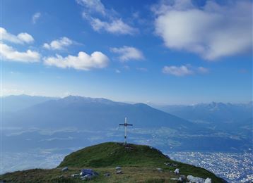
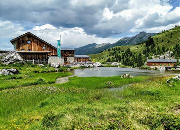
This hike takes you to the end of the Viggartal with it´s breath-taking "Blue lakes"
moderate
Distance 15.6 km
8:00 h
1,609 m
1,554 m
2,664 m
2,034 m
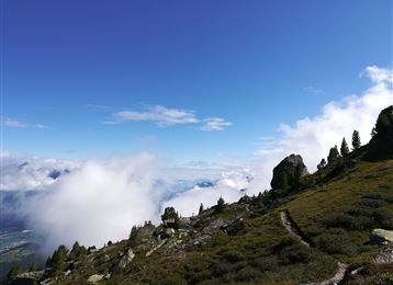
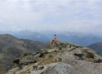
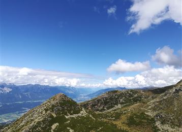
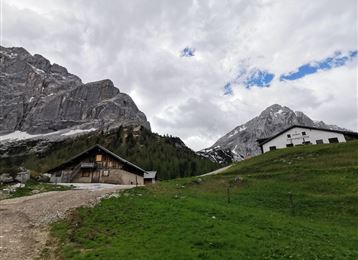
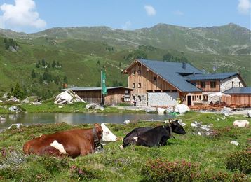
This hike leads from the Glungezer mountain station via the summit Glungezer to the Viggartal. Passing the legendary "G'schriebener Stoan", we continue to the magical Blue Lakes; the best place for a long break.

Author’s recommendation

Very colourful during the blossom of the "Alpenrosen".
Profile picture of Hall Wattens
Author
Hall Wattens
Update: July 07, 2023
Difficulty
moderate
Stamina
Experience
Landscape
Highest point
2,664 m
Lowest point
2,034 m
Best time of year
Jan
Feb
Mar
Apr
May
Jun
Jul
Aug
Sep
Oct
Nov
Dec
Cardinal direction
NESW

Track types

Asphalt 3.58%Path 95.24%Unknown 1.17%
Asphalt
0.6 km
Path
14.9 km
Unknown
0.2 km
Show elevation profile

Rest stops

Tulfeinalm 2035 M
Glungezer-Hut

Safety information


Tips and hints


Start

Glungezer, Tulfeinalm (2,033 m)
Coordinates:
DD
47.223300, 11.527600
DMS
47°13'23.9"N 11°31'39.4"E
UTM
32T 691355 5233078
w3w 
///gaping.saturated.capped

Destination

Blaue Seen

Turn-by-turn directions

High-altitude hike to the Upper Viggartal landscape protection area.

Down from summit Glungezer on AV-path 333. After an hour you turn left into the valley and climb back up to the Blue Lakes.

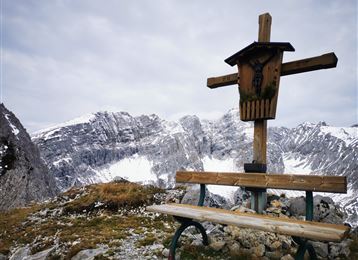
The flank uphill to the "G’schriebenen Stoan" ( "Written Stone") (2190m) - a large rock block on which, in addition to some contemporary inscriptions, ancient lettering can also be found. The "G’schriebenen Stoan" may have been a resting place or cult place for hunters and collectors of the Stone Age.

After a last steep step, the Blue Lakes are hidden at 2380m at the foot of the Kreuzspitze. This place invites you to rest.

The way back can be done the same way back - but before that, note the last descent of the Glungezer cable car!

Another option is the way out of the Viggartal via the Meissner Haus to Ellbögen. From there by bus back to Innsbruck.

For experienced mountaineers, the route from summit Glungezer along the Seven Tuxer Summits Route via the Kreuzspitze and down to the Blue Lakes is also recommended.

Public transport

Bus 4134

By road

Von der Autobahn -  Abfahrt Hall Mitte - Tulfes

Parking

Glungezerbahn

Coordinates

DD
47.223300, 11.527600
DMS
47°13'23.9"N 11°31'39.4"E
UTM
32T 691355 5233078
w3w 
///gaping.saturated.capped
Arrival by train, car, foot or bike

Similar routes nearby

  • A hike around the Glungezer Summit
  • From the Tulfeinalm to the peak of the Glungezer
  • Glungezer & Geier - High Altitude Trail
  • Naviser Jöchl
  • 4 peak tour at the Glungezer panoramic trail
 These suggestions were generated by our system
Difficulty
moderate
Distance
15.6 km
Duration
8:00 h
Ascent
1,609 m
Descent
1,554 m
Highest point
2,664 m
Lowest point
2,034 m
Out and back Refreshment stops available Geological highlights Flora Cableway ascent/descent

Statistics

  • Content
  • Show images Hide images
Features
Maps and trails
  • 5 Waypoints
  • 5 Waypoints
Distance  km
Duration : h
Ascent  m
Descent  m
Highest point  m
Lowest point  m
Push the arrows to change the view

Please wait

Accommodation is searched

Please be patient for a little more time

All data will be loaded in an instant