Hippoldspitze

Mountain Hike recommended route

Hippoldspitze

Mountain Hike · Hall-Wattens
Logo Tourismusverband Region Hall-Wattens
Responsible for this content
Tourismusverband Region Hall-Wattens Verified partner  Explorers Choice 
  • Photo: Anne W., Tourismusverband Region Hall-Wattens
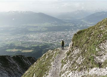
Up to the summit of the Hippoldspitze in the Tux Alps
difficult
Distance 13.7 km
6:30 h
1,221 m
1,221 m
2,625 m
1,404 m
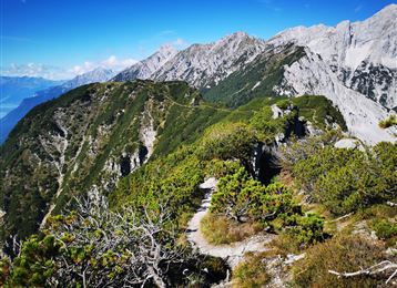
The Hippold is one of the mostly unknown summits of the Tux Prealps. Actually incomprehensible, it offers everything that makes a mountaineer's heart beat faster!
Profile picture of Anne W.
Author
Anne W. 
Update: April 07, 2020
Difficulty
difficult
Technique
Stamina
Experience
Landscape
Highest point
2,625 m
Lowest point
1,404 m
Best time of year
Jan
Feb
Mar
Apr
May
Jun
Jul
Aug
Sep
Oct
Nov
Dec

Track types

Asphalt 1.34%Dirt road 16.19%Forested/wild trail 44.39%Path 38.06%
Asphalt
0.2 km
Dirt road
2.2 km
Forested/wild trail
6.1 km
Path
5.2 km
Show elevation profile

Safety information

Keep in mind that you are in an army area.

Start

Lager Walchen (1,403 m)
Coordinates:
DD
47.209111, 11.624728
DMS
47°12'32.8"N 11°37'29.0"E
UTM
32T 698761 5231744
w3w 
///absorption.ants.giver

Destination

Lager Walchen

Turn-by-turn directions

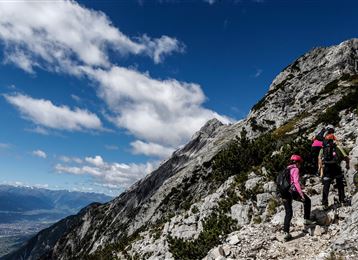
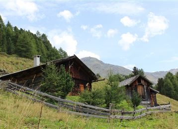
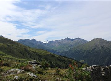
From the parking place Lager Walchen, we go to the Aussermelan Alm Niederleger and on to the Aussermelan Alm Hochleger. From the Hochleger we keep heading to the south and follow the path through the wide alpine meadows to the Krovenzjoch (pass). When we reach the Krovenzjoch, we almost made it. Following a steep, marked track we climb the summit of the Hippoldspitze in about 30 minutes.


367/5000


From the Lager Walchen, we hike to the Aussermelan Alm Niederleger and on to the Aussermelan Alm Hochleger. From the Hochleger we keep heading to the south and follow the path through the wide alpine meadows to the Krovenzjoch (ridge). When we reach the Krovenzjoch, we almost made it. Following steep, marked tracks about 30 minutes up, we make it to the summit of the Hippoldspitze.


By road

Wattens - Wattenberg - Lager Walchen

Parking

Lager Walchen

Coordinates

DD
47.209111, 11.624728
DMS
47°12'32.8"N 11°37'29.0"E
UTM
32T 698761 5231744
w3w 
///absorption.ants.giver
Arrival by train, car, foot or bike

Similar routes nearby

  • Map / Geier
    Geier
  • Wattental - Möstal - Lizumer Mountain Hut
  • Hirzer
  • Lizumer Reib`n Rundtour
  • Kalkwand Umrundung
  • Glungezer & Geier - High Altitude Trail
  • From the Tulfeinalm to the peak of the Glungezer
 These suggestions were generated by our system
Difficulty
difficult
Distance
13.7 km
Duration
6:30 h
Ascent
1,221 m
Descent
1,221 m
Highest point
2,625 m
Lowest point
1,404 m
Multi-stage route Scenic Refreshment stops available Insider tip Summit route

Statistics

  • Content
  • Show images Hide images
Features
Maps and trails
Distance  km
Duration : h
Ascent  m
Descent  m
Highest point  m
Lowest point  m
Push the arrows to change the view

Please wait

Accommodation is searched

Please be patient for a little more time

All data will be loaded in an instant