Der Wilde Bande Steig

Mountain Hike recommended route

Der Wilde Bande Steig

Mountain Hike · Hall-Wattens
Logo Tourismusverband Region Hall-Wattens
Responsible for this content
Tourismusverband Region Hall-Wattens Verified partner  Explorers Choice 
  • Austieg am Stempeljoch
    Austieg am Stempeljoch
    Photo: Anne W., Tourismusverband Region Hall-Wattens

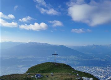
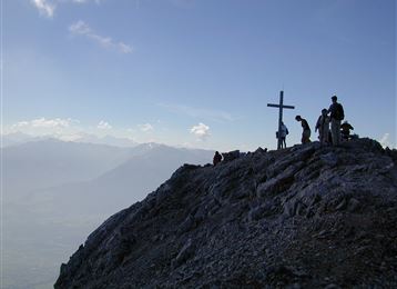
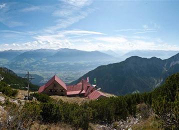
Die 1878 gegründete Bergsteigergruppe „Wilde Bande“, die mit den Salzbergknappen eng verbunden war, baute 1929 den Steig vom Lafatscherjoch zum Stempeljoch

difficult
Distance 17.9 km
7:00 h
1,984 m
520 m
2,281 m
807 m

Der gesamte Steig von der Bettelwurfhütte über den „Stempel“, durch die Pfeis zum Hafelekar heißt „Innsbrucker Höhenweg“.

Vom Hafelekar Talfahrt mit der Nordketten-Seilbahn und mit der Hungerburgbahn nach Innsbruck, per Bus nach Hall.

Profile picture of Hall Wattens
Author
Hall Wattens
Update: March 28, 2023
Difficulty
difficult
Technique
Stamina
Experience
Landscape
Highest point
2,281 m
Lowest point
807 m
Best time of year
Jan
Feb
Mar
Apr
May
Jun
Jul
Aug
Sep
Oct
Nov
Dec

Track types

Show elevation profile

Tips and hints

http://www.hall-wattens.at/


Start

Absam, Eingang Halltal (806 m)
Coordinates:
DD
47.311232, 11.518196
DMS
47°18'40.4"N 11°31'05.5"E
UTM
32T 690328 5242826
w3w 
///consideration.repack.offices

Destination

Innsbruck, Hafelekarspitz

Turn-by-turn directions

Vom Parkplatz Halltal-Eingang startet man durch das Halltal zum Gasthof St. Magdalena und weiter bis knapp unter das Issjöchl. Von hier quert man in einem großen Bogen über den Wilde- Bande Steig zum Stempeljoch. Nach dem anstrengenden Aufstieg zum Stempeljoch geht es bergab zur Pfeishütte oder an der Rumerspitze orientierend ohne Höhenverlust zur Mandlscharte.

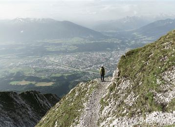
Nachdem die Mandlscharte erreicht wurde, geht es von dort entlang des Goethe- Weges mit atemberaubenden Tiefblicken zur Bergstation der Nordkettenbahn.

Von hier geht es gemütlich mit der Seilbahn hinunter bis nach Innsbruck.


Public transport

Es besteht die Möglichkeit mit der „Linie DE“ (IVB Bus) den Ausgangspunkt zu erreichen.

Die Station "Eichat Bettelwurfsiedlung" befindet sich 5 Gehminuten vom Eingang Halltal entfernt.

Nähere Informationen unter:

http://www.vvt.at

Parking

Parkplatz Halltal (Absam) - kostenfrei

Coordinates

DD
47.311232, 11.518196
DMS
47°18'40.4"N 11°31'05.5"E
UTM
32T 690328 5242826
w3w 
///consideration.repack.offices
Arrival by train, car, foot or bike

Similar routes nearby

  • Through the Halltal (valley) to the Halleranger
  • Speckkarspitze
  • Through the Halltal to the peak of the Bettelwurf
  • From the Halltal to the Bettelwurf Mountain Hut
  • Über die Zunterköpfe zur Kaisersäule
  • Gnadenwald - Hinterhornalm - Hundskopf
  • Lippenkopf
 These suggestions were generated by our system
Difficulty
difficult
Distance
17.9 km
Duration
7:00 h
Ascent
1,984 m
Descent
520 m
Highest point
2,281 m
Lowest point
807 m
Linear route

Statistics

  • Content
  • Show images Hide images
Features
Maps and trails
  • 6 Waypoints
  • 6 Waypoints
Distance  km
Duration : h
Ascent  m
Descent  m
Highest point  m
Lowest point  m
Push the arrows to change the view

Please wait

Accommodation is searched

Please be patient for a little more time

All data will be loaded in an instant