Hiking

Medium

Von Gandenwald/Kranzach zur Walderalm

Hiking route

9,88 km

04:30 h

611 hm

612 hm

1502 m

Best Time of Year

Jan

Feb

Mar

Apr

May

Jun

Jul

Aug

Sep

Oct

Nov

Dec

Information

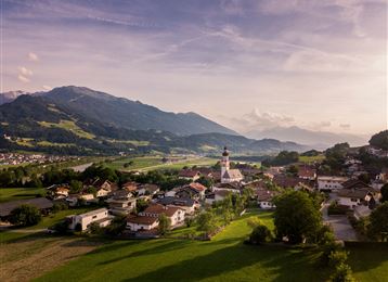
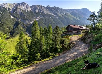
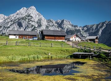
Von Kranzach auf dem Gnadenwalder Plateau hinauf zur Walderalm, dort öffnet sich der Blick auf das Karwendel und das Inntal.

Features & Properties

Stamina

Experience

Landscape

Map & Elevation Profile

Arrival

Inntalautobahn A12, Ausfahrt Hall Mitte, dann einfach weiter über die Verbindungsstrasse Hall in Tirol - Absam – Gnadenwald.

Similar Tour Suggestions
The Eagles´ Trail – From mountain solitude into the town (12)

Hard

Hiking

Long-Distance Hiking

13,14 km

07:06 h

1949 hm

1448 hm

2498 m

Teufelsmühle

Easy

Hiking

Hiking route

12,81 km

04:30 h

330 hm

325 hm

1023 m

Wurzelschellweg

Medium

Hiking

Hiking route

6,10 km

02:00 h

378 hm

892 m

Rundwanderweg Voldertal

Medium

Hiking

Hiking route

9,65 km

03:30 h

75 hm

707 hm

1561 m

Munich - Venice: Through the Wattental to the Lizumer Hütte

Medium

Hiking

Long-Distance Hiking

26,69 km

08:00 h

1604 hm

377 hm

2019 m

Senselerweg: Toldern über Steinernes Lamm zur Geraerhütte

Medium

Hiking

Long-Distance Hiking

9,47 km

04:30 h

1067 hm

218 hm

2489 m

Via Alpina - Red trail - From the Inn valley to the north - Naturpark Karwendel

Hard

Hiking

Stage 4 - Karwendel Höhenweg

Hard

Hiking

Long-Distance Hiking

8,99 km

04:30 h

590 hm

390 hm

2218 m