Stage 5 - Karwendel Höhenweg

Long-Distance Hiking recommended route

Stage 5 - Karwendel Höhenweg

Long-Distance Hiking · Hall-Wattens
Logo Tourismusverband Region Hall-Wattens
Responsible for this content
Tourismusverband Region Hall-Wattens Verified partner  Explorers Choice 
  • Photo: Anne W., Tourismusverband Region Hall-Wattens

TAKING THE OLD MULE TRACK THROUGH THE CLEARING

A mule track is a trail that is too steep for wagons and carriages and was formerly used by drivers of mule trains, who had their animals transport goods from one valley to the next.

difficult
Distance 9.1 km
6:00 h
800 m
1,100 m
2,694 m
1,761 m
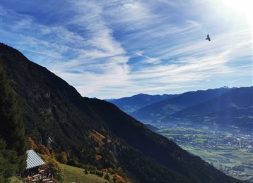
After spending the night at the Bettelwurfhütte hut, the eagle’s nest of the Karwendel mountains, you take trail 222 back to the Lafatscher Joch (2081 m). Once there, you turn on to trail 223 heading north. As part of the famous Adlerweg long-distance hiking trail, this guides you between the Lafatscher, Roßkopf and Speckkarspitze mountains on a continuous descent to the Hallerangerhaus hut.

Author’s recommendation

Good to know:

The trail through the blasted clearing from the Hallerangerhaus to the Lafatscher Joch is a typical mule track. This leads between the Lafatscher Roßkopf, the Kleiner Lafatscher and the Speckkarspitze mountains, thus connecting the Halleranger to the Halltal valley and the Bettelwurfhütte to the Hallerangerhaus.

Profile picture of Anne W.
Author
Anne W. 
Update: July 04, 2023
Difficulty
difficult
Technique
Stamina
Experience
Landscape
Highest point
2,694 m
Lowest point
1,761 m
Best time of year
Jan
Feb
Mar
Apr
May
Jun
Jul
Aug
Sep
Oct
Nov
Dec

Track types

Show elevation profile

Rest stops

Bettelwurf-Hütte
Hallerangerhaus

Safety information

Recommended equipment: ankle-high mountain boots, sufficient water

Tips and hints

Hüttenabfrage

Karwendel Höhenweg

Bettelwurfhütte

Hallerangerhaus

Start

Bettelwurfhütte (2,080 m)
Coordinates:
DD
47.338619, 11.507492
DMS
47°20'19.0"N 11°30'27.0"E
UTM
32T 689421 5245843
w3w 
///cocktails.newsstand.maxims

Destination

Hallerangerhaus

Turn-by-turn directions

Für alle konditionsstarken BergsteigerInnen, die sich fit fühlen und über das nötige körperliche und technische Rüstzeug verfügen, optional auf den Großen Bettelwurf. Zuerst geht man ostwärts, gut ausgeschildert, in den Graben, wo der Steig aus dem Halltal heraufführt und dann weiter ansteigend südostwärts zum „Eisengattergrat“, dem Südrücken des Großen Bettelwurfs. Von hier aus hält man sich nördlich, stetig am Eisengattergrat bergan, Richtung Gipfel bis zum Felsansatz und den ersten drahtseilversicherten Passagen. Die folgende, teilweise versicherte und teils in leichter Kletterei (I) zu überwindende Steiganlage in gut griffigem Kalkgestein, führt nun meist rechts einer schräg herabziehenden Rinne bis zum Gipfelgrat und überwindet dabei einige teils ausgesetzte Felsbänder. Eine Klettersteigausrüstung samt Helm wird hierfür ausdrücklich empfohlen. Nach oben hin wird der Steig etwas steiler. Kurz unterhalb des Gipfelgrates teilt sich der Steig, wobei der von unten gesehen linke Steig leichter zu begehen ist. Am Gipfelgrat hält man sich nach Osten und gelangt über ein schmaleres, nach beiden Seiten ausgesetztes Gratstück, bis zum Gipfelkreuz. Vom Gipfel geht es auf gleichem Weg wieder retour zur Bettelwurfhütte.

Nach einer Stärkung geht es auf Steig 222 zurück zum Lafatscher Joch (2081 m). Dort zweigt man in nördlicher Richtung auf den Steig 223 ein. Dieser Weg ist auch ein Teil des berühmten Weitwanderweges „Adlerweg“. Zwischen Lafatscher, Lafatscher Roßkopf und Speckkarspitze hindurch wandert man stets bergab zum schön gelegenen Hallerangerhaus.

Coordinates

DD
47.338619, 11.507492
DMS
47°20'19.0"N 11°30'27.0"E
UTM
32T 689421 5245843
w3w 
///cocktails.newsstand.maxims
Arrival by train, car, foot or bike

Equipment

knöchelhohe Bergschuhe, ausreichend Wasser

Klettersteigset mit Helm zur Begehung des Großen Bettelwurfs

Similar routes nearby

  • Munich - Venice: From Halleranger to Hall
  • The Eagles´ Trail – From mountain solitude into the town (12)
  • Stage 6 - Karwendel Höhenweg
  • Munich - Venice: Through the Wattental to the Lizumer Hütte
  • Stage 4 - Karwendel Höhenweg
 These suggestions were generated by our system
Difficulty
difficult
Distance
9.1 km
Duration
6:00 h
Ascent
800 m
Descent
1,100 m
Highest point
2,694 m
Lowest point
1,761 m
Multi-stage route Scenic Linear route

Statistics

  • Content
  • Show images Hide images
Features
Maps and trails
  • 2 Waypoints
  • 2 Waypoints
Distance  km
Duration : h
Ascent  m
Descent  m
Highest point  m
Lowest point  m
Push the arrows to change the view

Please wait

Accommodation is searched

Please be patient for a little more time

All data will be loaded in an instant