Via Ferrata at the Hundskopf

Via Ferrata recommended route

Via Ferrata at the Hundskopf

Via Ferrata · Hall-Wattens
Logo Tourismusverband Region Hall-Wattens
Responsible for this content
Tourismusverband Region Hall-Wattens Verified partner  Explorers Choice 
  • Vorm Gipfel
    Vorm Gipfel
    Photo: Hall Wattens, Tourismusverband Region Hall-Wattens

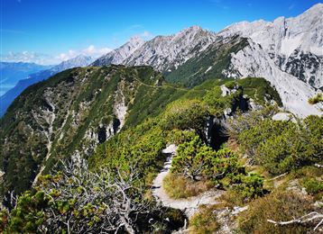
Short and quite easy Via Ferrata up to the Hundskopf


difficult
Distance 3.9 km
4:00 h
712 m
712 m
2,238 m
1,526 m

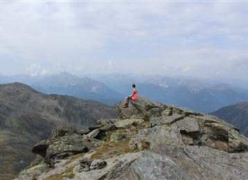
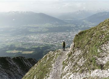
This fixed-rope tour is short and quite easy via the Felix-Kuen-Klettersteig up the Hundskopf.


Author’s recommendation

Because of the sunfaced side it can get very hot during the summer months.


Profile picture of Hall Wattens
Author
Hall Wattens
Update: April 25, 2022
Difficulty
B/C difficult
Stamina
Experience
Landscape
Highest point
2,238 m
Lowest point
1,526 m
Best time of year
Jan
Feb
Mar
Apr
May
Jun
Jul
Aug
Sep
Oct
Nov
Dec

Track types

Asphalt 0.15%Path 51.42%Unknown 48.41%
Asphalt
0 km
Path
2 km
Unknown
1.9 km
Show elevation profile

Safety information

2012 generalsaniert. Klettersteigausrüstung erforderlich. Schwierigkeit B/C.

Start

Gnadenwald, Hinderhornalm (1,526 m)
Coordinates:
DD
47.333770, 11.564630
DMS
47°20'01.6"N 11°33'52.7"E
UTM
32T 693754 5245445
w3w 
///bitty.appoints.bulldozer

Destination

Karwendel, Hundskopf

Turn-by-turn directions

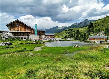
Via the toll road to the Hinterhornalm. Here begins the route to the Hundskopf 2.243m.

Starting from the parking lot we turn left and hike the path up. After 20 minutes we reach a steep path which brings us up the tree line.

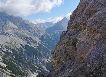
From here on its rocky and you need a little bit more sure-footedness.  Now via the Felix-Kuen Via Ferrata up to the Hundskopf.


The descent goes along the eastern mountain ridge


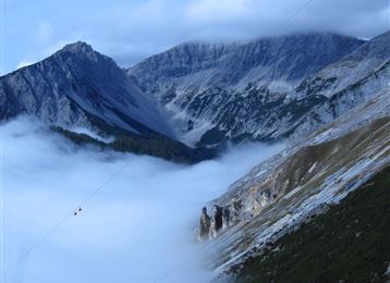
You should not miss the breath-taking views down to the Vomperloch.


By road

Hall - Absam - Gnadenwald - Mautstraße Hinterhornalm

Parking

Parkplatz Hinterhonalm

Coordinates

DD
47.333770, 11.564630
DMS
47°20'01.6"N 11°33'52.7"E
UTM
32T 693754 5245445
w3w 
///bitty.appoints.bulldozer
Arrival by train, car, foot or bike

Equipment

Klettersteigausrüstung

Similar routes nearby

  • Via Ferrata Absam
  • Glungezer Via Ferrata
 These suggestions were generated by our system
Difficulty
B/C difficult
Distance
3.9 km
Duration
4:00 h
Ascent
712 m
Descent
712 m
Highest point
2,238 m
Lowest point
1,526 m
Out and back Scenic Refreshment stops available Summit route

Statistics

  • Content
  • Show images Hide images
Features
Maps and trails
  • 2 Waypoints
  • 2 Waypoints
Distance  km
Duration : h
Ascent  m
Descent  m
Highest point  m
Lowest point  m
Push the arrows to change the view

Please wait

Accommodation is searched

Please be patient for a little more time

All data will be loaded in an instant