Hiking

Easy

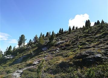
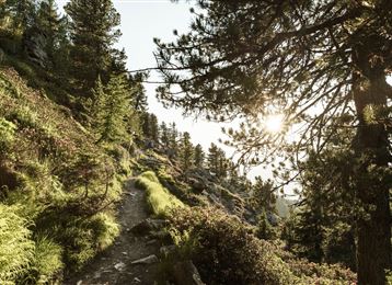
Panoramic views at the trail Hinterhornalm - Walderalm

Hiking route

3,58 km

01:20 h

243 hm

1630 m

Best Time of Year

Jan

Feb

Mar

Apr

May

Jun

Jul

Aug

Sep

Oct

Nov

Dec

Information

Panoramic view - one after the other

Features & Properties

Stamina

Experience

Landscape

Map & Elevation Profile

Arrival

Inntalautobahn A12, Ausfahrt Hall-Mitte, dann einfach weiter über die Verbindungsstrasse Hall in Tirol - Absam – Gnadenwald

Similar Tour Suggestions
Munich - Venice: Through the Wattental to the Lizumer Hütte

Medium

Hiking

Long-Distance Hiking

26,69 km

08:00 h

1604 hm

377 hm

2019 m

Closed
On the panoramic Hochmahdkopf

Medium

Hiking

Hiking route

8,13 km

04:00 h

963 hm

958 hm

1736 m

Rote Wand

Medium

Hiking

Hiking route

12,31 km

05:30 h

980 hm

978 hm

2215 m

Senselerweg: Himmelreich über Volderwildbad zur Voldertalhütte

Medium

Hiking

Long-Distance Hiking

13,88 km

04:30 h

826 hm

120 hm

1382 m

Ganalm-Walderalm

Hard

Hiking

Hiking route

15,42 km

04:00 h

662 hm

672 hm

1502 m

Durch das Halltal auf das Lafatscherjoch

Hard

Hiking

Hiking route

17,51 km

07:30 h

1365 hm

2085 m

Milser Skulpturenweg

Easy

Running

Nature Trail

2,14 km

00:30 h

20 hm

652 m

Stage 2 Wattens to Tulfes

Hard

Hiking

Long-Distance Hiking

19,22 km

06:30 h

1147 hm

788 hm

1561 m