Hiking

Medium

Bergsagen long-distance hiking trail: stage 4 from Thaur to Gnadenwald

Long-Distance Hiking

16,22 km

07:30 h

1309 hm

1056 hm

1804 m

Best Time of Year

Jan

Feb

Mar

Apr

May

Jun

Jul

Aug

Sep

Oct

Nov

Dec

Information

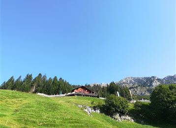
From Thaur you climb up to the Romedikirchl, which is visible from afar, and to the Thaurer castle ruins. From here, follow the old Thaurer Alm path to the Thaurer Alm. Here the first ascent is done and you can enjoy the beautiful view from the alpine terrace.

Then continue eastwards

Features & Properties

Stamina

Experience

Landscape

Map & Elevation Profile

Similar Tour Suggestions
Walderalm

Hard

Hiking

Hiking route

15,42 km

04:00 h

662 hm

672 hm

1502 m

Rundwanderweg Voldertal

Medium

Hiking

Hiking route

9,65 km

03:30 h

75 hm

707 hm

1561 m

Thaurer Alm

Medium

Hiking

Hiking route

7,31 km

04:15 h

636 hm

635 hm

1462 m

Etappe 5 - Karwendel Höhenweg

Hard

Hiking

Long-Distance Hiking

9,09 km

06:00 h

800 hm

1100 hm

2694 m

Der Doppelgipfel der Naviser Sonnenspitze

Hard

Hiking

Hiking route

22,93 km

08:00 h

1516 hm

1514 hm

2617 m

Richtung Rinner Alm

Medium

Hiking

Hiking route

11,12 km

04:00 h

759 hm

772 hm

1740 m

Lizumerhütte im Wattental

Medium

Hiking

Long-Distance Hiking

26,69 km

08:00 h

1604 hm

377 hm

2019 m

Voldertalhütte

Medium

Hiking