Waldrunde Wattenberg

Hiking route recommended route

Waldrunde Wattenberg

Hiking route · Hall-Wattens closed
Logo Tourismusverband Region Hall-Wattens
Responsible for this content
Tourismusverband Region Hall-Wattens Verified partner  Explorers Choice 
  • Wattenberg
    Wattenberg
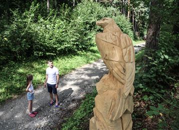
    Photo: Hall Wattens, Tourismusverband Region Hall-Wattens
This route passes through an inaccessible area and is therefore closed. Current information

Runde im schattigen Wald

closed
moderate
Distance 19.4 km
6:30 h
891 m
899 m
1,819 m
953 m

Schattige Walrunde am Wattenberg

Author’s recommendation

Schattige Waldrunde mit Abkühlung am Bach!

Profile picture of Hall Wattens
Author
Hall Wattens
Update: March 23, 2023
Difficulty
moderate
Stamina
Experience
Landscape
Highest point
1,819 m
Lowest point
953 m
Best time of year
Jan
Feb
Mar
Apr
May
Jun
Jul
Aug
Sep
Oct
Nov
Dec

Track types

Asphalt 4.78%Dirt road 41.35%Forested/wild trail 36.56%Path 13.55%Road 3.73%
Asphalt
0.9 km
Dirt road
8 km
Forested/wild trail
7.1 km
Path
2.6 km
Road
0.7 km
Show elevation profile

Tips and hints

http://www.hall-wattens.at/ 

Start

Wattenberg, Gasthof Mühle (1,005 m)
Coordinates:
DD
47.263404, 11.611548
DMS
47°15'48.3"N 11°36'41.6"E
UTM
32T 697561 5237744
w3w 
///involving.round.amble

Destination

Wattenberg, Gasthof Mühle

Turn-by-turn directions

Vom Gasthof Mühle ziehen wir hinauf nach Wildstätt zum Dörfl (bis hierher auch mit dem Auto und parken).

Der Wald-Rundweg geleitet uns vom Dörfl (1601 m) und unterhalb der Roten Wand und dem Poferer Jöchl entlang. Hier können wir die Runde bis zum Gasthof Haneburger fortsetzen und am Bach entlang geht es zur „Säge“ und „Mühle“ zurück.

Note

Wildlife protection area Wald- und Wildschutzzone, Schutzgut: Rothirsch (Innsbruck Land): closed today
all notes on protected areas

Parking

Direkt beim Ausgangpunkt befinden sich Parkmöglichkeiten.

Coordinates

DD
47.263404, 11.611548
DMS
47°15'48.3"N 11°36'41.6"E
UTM
32T 697561 5237744
w3w 
///involving.round.amble
Arrival by train, car, foot or bike

Similar routes nearby

  • Rote Wand
  • Wurzelschellweg
  • Hinauf auf den Largoz
  • Wattens - Kolsass
  • Entlang des Voldertalbaches zur Steinkasernalm
 These suggestions were generated by our system
Status
closed
Difficulty
moderate
Distance
19.4 km
Duration
6:30 h
Ascent
891 m
Descent
899 m
Highest point
1,819 m
Lowest point
953 m
Round trip Scenic

Statistics

  • Content
  • Show images Hide images
Features
Maps and trails
Distance  km
Duration : h
Ascent  m
Descent  m
Highest point  m
Lowest point  m
Push the arrows to change the view

Please wait

Accommodation is searched

Please be patient for a little more time

All data will be loaded in an instant