Guggerinsel Circuit

Nordic Walking recommended route

Guggerinsel Circuit

Nordic Walking · Region Innsbruck
Logo Tourismusverband Region Hall-Wattens
Responsible for this content
Tourismusverband Region Hall-Wattens Verified partner  Explorers Choice 
  • Guggerinsel
    Guggerinsel
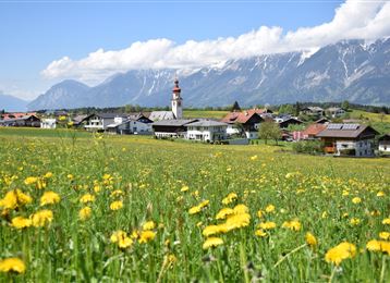
    Photo: Hall Wattens, Tourismusverband Region Hall-Wattens
The route runs along the Inn and circles the Guggerinsel or Gugger Island. The circuit is particularly suitable for beginners
easy
Distance 3.2 km
0:40 h
7 m
1 m
562 m
554 m
The beautiful recreation area of Hall.
Profile picture of Hall Wattens
Author
Hall Wattens
Update: September 26, 2023
Difficulty
easy
Stamina
Experience
Landscape
Highest point
562 m
Lowest point
554 m
Best time of year
Jan
Feb
Mar
Apr
May
Jun
Jul
Aug
Sep
Oct
Nov
Dec

Track types

Show elevation profile

Tips and hints

http://www.hall-wattens.at

Start

Innsteg (554 m)
Coordinates:
DD
47.277109, 11.508898
DMS
47°16'37.6"N 11°30'32.0"E
UTM
32T 689747 5239011
w3w 
///lorry.rally.spicy

Destination

Innsteg

Turn-by-turn directions

The route starts off from Innsteg and leads along the Inn toward the east. After passing the Guggerinsel playground, you turn around again at the bridge in order to head back along the railway embankment. The route leads past the sports ground to the large bridge over the Inn. Pass beneath the bridge and head back to the starting point.

Public transport

Von Innsbruck können Sie unter anderem die "Linie 504" nehmen.

Von der Station "Unterer Stadtplatz" sind es circa 5 Gehminuten bis zum Ausgangspunkt.

Nähere Informationen unter:

www.vvt.at

By road

Aus Deutschland : Grenzübergang Kiefersfelden - Kufstein - ca. 70 km nach Hall über Autobahn A 12 - Ausfahrt Hall Mitte

Aus Italien : Grenzübergang Brenner nach Innsbruck - ca 10 km nach Hall über Autobahn A 12  -> Ausfahrt Hall Mitte

Aus der Schweiz : Landeck - Autobahn bis Hall ca. 80 km ->Ausfahrt Hall Mitte

Coordinates

DD
47.277109, 11.508898
DMS
47°16'37.6"N 11°30'32.0"E
UTM
32T 689747 5239011
w3w 
///lorry.rally.spicy
Arrival by train, car, foot or bike

Similar routes nearby

  • Tempo Course
  • Speckbacher Circuit
  • Connection route Tulfes - Judenstein
  • Lavierenbad Circuit
  • Weissenbach circuit
 These suggestions were generated by our system
Difficulty
easy
Distance
3.2 km
Duration
0:40 h
Ascent
7 m
Descent
1 m
Highest point
562 m
Lowest point
554 m
Out and back

Statistics

  • Content
  • Show images Hide images
Features
Maps and trails
Distance  km
Duration : h
Ascent  m
Descent  m
Highest point  m
Lowest point  m
Push the arrows to change the view

Please wait

Accommodation is searched

Please be patient for a little more time

All data will be loaded in an instant