Connection route Tulfes - Judenstein

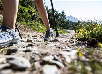
Nordic Walking recommended route

Connection route Tulfes - Judenstein

Nordic Walking · Hall-Wattens
Logo Tourismusverband Region Hall-Wattens
Responsible for this content
Tourismusverband Region Hall-Wattens Verified partner  Explorers Choice 
  • Photo: Hall Wattens, Tourismusverband Region Hall-Wattens
The connection to Judenstein allows a connection to the route network of the running and Nordic walking centre of excellence in Innsbruck-Igls
easy
Distance 4.5 km
1:05 h
106 m
86 m
994 m
893 m
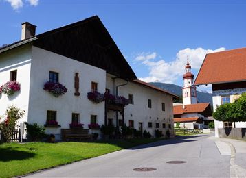
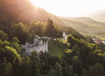
Perfect route to get to know the area between Tulfes and Rinn.
Profile picture of Hall Wattens
Author
Hall Wattens
Update: July 07, 2023
Difficulty
easy
Stamina
Experience
Landscape
Highest point
994 m
Lowest point
893 m
Best time of year
Jan
Feb
Mar
Apr
May
Jun
Jul
Aug
Sep
Oct
Nov
Dec

Track types

Asphalt 38.29%Dirt road 39.27%Forested/wild trail 10.97%Path 11.31%Road 0.13%
Asphalt
1.7 km
Dirt road
1.8 km
Forested/wild trail
0.5 km
Path
0.5 km
Road
0 km
Show elevation profile

Tips and hints

http://www.hall-wattens.at/


Start

Tulfes, Ortsmitte (903 m)
Coordinates:
DD
47.259317, 11.534089
DMS
47°15'33.5"N 11°32'02.7"E
UTM
32T 691716 5237096
w3w 
///restrict.umpires.flip

Destination

Judenstein

Turn-by-turn directions

The route starts off at the Tourist Office in Tulfes and heads to the running and Nordic walking centre of excellence in Innsbruck-Igls. The route initially goes along the Speckbacher Trail toward Rinn. When you reach Lavierenbad the route then turns off and heads down to Judenstein. The route features moderate gradients that make it ideal for you to familiarise yourself with the region.

Public transport

Public-transport-friendly

Col'autobus numero 4134 da Hall o Innsbruck si arriva direttamente al punto di partenza.

La fermata dove si scende si chiama "Tulfes Volksschule".

By road

Hall Mitte - Tulfes

Parking

Direkt beim Ausgangspunkt befinden sich Parkmöglichkeiten.

Coordinates

DD
47.259317, 11.534089
DMS
47°15'33.5"N 11°32'02.7"E
UTM
32T 691716 5237096
w3w 
///restrict.umpires.flip
Arrival by train, car, foot or bike

Similar routes nearby

  • Lavierenbad Circuit
  • Speckbacher Circuit
  • Guggerinsel Circuit
  • Tempo Course
  • Weissenbach circuit
 These suggestions were generated by our system
Difficulty
easy
Distance
4.5 km
Duration
1:05 h
Ascent
106 m
Descent
86 m
Highest point
994 m
Lowest point
893 m
Public-transport-friendly Scenic Family-friendly

Statistics

  • Content
  • Show images Hide images
Features
Maps and trails
  • 1 Waypoints
  • 1 Waypoints
Distance  km
Duration : h
Ascent  m
Descent  m
Highest point  m
Lowest point  m
Push the arrows to change the view

Please wait

Accommodation is searched

Please be patient for a little more time

All data will be loaded in an instant