





The Mysterious Voldertal Valley


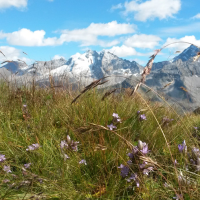
The valley winds gently to the left, stretching into the Tux Alps as far as the 2,479-metre-high Naviser Jöchl. Mass tourism is unheard of in the Voldertal. Consequently, whilst there are many alpine pastures, they are alpine pastures in the traditional sense and not restaurants.

In summer, livestock – mostly cattle, but also sheep and goats – are kept on the alpine pastures in the Voldertal valley. Many paths in the Voldertal valley clearly show that they are only rarely used. Often, they are merely faint trails that wind more or less clearly through the terrain and are sometimes barely marked. A good hiking map is a great help in the Voldertal in particular.
Using three walks in the valley, I’d like to share a few impressions of this valley. The first walk is easy, the second requires sure-footedness and a certain amount of stamina, whilst the third is an excursion into the pathless high-alpine region. Even though the terrain there isn’t really difficult, this tour requires alpine experience and a good sense of direction.
Walk via the Stiftsalm in the Voldertal valley
A one-hour walk around the Stiftsalm gives us a first impression of the Voldertal valley. We set off from the car park just behind the Volderwildbad. For centuries, visitors came to the Volderwildbad to find peace and healing, before the spa closed in 1965. Today, the complex – including the chapel dedicated to Saints Cosmas and Damian – has been renovated and is a popular venue for weddings.
From the car park, we follow the road towards Windegg for half a kilometre before a path on the left leads us back up into the forest. After a few metres, we see a grotto with guardian angels carved into the rock on the right.

The Stiftsalm in the Voldertal valley
The path continues past boulders covered in ferns and moss before widening into a cart track. Soon afterwards, we reach the undulating meadows of the Stiftsalm. At the alp, the Chapel of Our Lady of Sorrows, with its onion-domed spire, is particularly eye-catching.
The Stiftsalm and its Oberleger were farms operated all year round until the 16th century. Then the Haller Damenstift purchased the two farms and converted them into alpine pastures to provide for the abbey’s livestock. However, the nuns of the convent are said not to have had the best reputation. A legend tells of a miserly abbess who strictly forbade the herdsmen and herdswomen from giving beggars even the slightest thing. They were told to throw it to the pigs instead. Shortly after her death, the abbess is said to have appeared on the Stiftsalm riding a white grey horse. Even in later times, there are said to have been repeated ghostly apparitions on the alp; for instance, there was frequent talk of the ‘Stiftsgeist’ (the convent ghost).
When the mountain pasture is in operation, we can stop here for some fresh milk before following the track a few hundred metres further into the valley and then walking back out to Volderwildbad via the Voldertal road.
In the heart of the Voldertal valley
On this second hike, we’ll visit the heart of the Voldertal valley, the mystical Schwarzbrunn forest clearing and the Gwannalm above it.
On the Voldertal road, we can drive a few more kilometres further into the valley from Volderwildbad, as we paid a four-euro toll at the machine at the last farmhouse before Volderwildbad. The drive to the Nößlach car park saves us an hour’s walk. Incidentally, a ten-minute walk below the car park, right by the stream, lies the Voldertalhütte run by the Naturfreunde, which is open from early May to late October and where you can also stay overnight.
From the gate by the Nößlach car park, we walk half an hour up the valley to the Schwarzbrunn. For me, this is where the heart of the Voldertal beats. The woodland clearing, through which the Voldertalbach flows, is strewn with boulders. Rootstocks covered in lichen jut up into the air, with small streams flowing between them, alongside which marsh marigolds display their yellow splendour in early summer.
There may once have been a lake here; at least, the legend of the Glungezer Giant tells of one. In revenge for his spurned love, the giant who dwelt on the Glungezer sent the royal palace—with its king and four charming daughters—tumbling down into the valley in a huge avalanche of stones. On moonlit nights, the drowned king’s daughters are said to have floated above the lake. The giant, however, cursed himself for his deed and plunged into the lake as a dwarf.
From Schwarzbrunn, we follow the path up to Klausboden, where we cross the Voldertalbach via an iron footbridge and continue on to the Gwannalm. Five minutes before reaching the Gwannalm, the path veers off to the right and leads back down to Schwarzbrunn. Before taking the narrow path to Schwarzbrunn, we take a quick look over towards the alpine pasture.


An unusual lake
However, not everything in the Voldertal valley is accessible via footpaths. Deep in the Voldertal valley lies a mysterious lake whose waters flow down the mountainside. Its water trickles over a small rocky cliff into an adjacent stream, only to disappear on the spot along with the stream. Underground, the water makes its way down the valley and only returns to the surface a good distance further down.

If we walk a little under a quarter of an hour further eastwards from the lake, up through the valley, we come to the disused mine in Eisenkar. Even today, the remains of a miners’ hut, a buried tunnel entrance and piles of red iron ore on the ground bear witness to the miners’ work. Around 200 to 300 years ago, they extracted iron ore from the mountain here, crushed it at the sites still visible today, and separated it from the barren rock.
These three suggestions may inspire you to set off on your own journey of discovery in the Voldertal valley. I do this time and again and write about it on my blog www.voldertal.at.