Powerful Place. Lake Mölssee in the Wattener Lizum
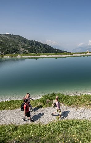
Although Lake Mölssee is the most difficult of our power spots to reach, it is impossible to escape its fascination. The clear water and the mountain scenery do much to help you escape from everyday life and feel free and carefree. After all, spending time in nature is a great way to recharge your batteries for everyday life.
The Mölssee power spot in the Wattener Lizum at a glance
- fantastic Tux Alps
- Fish in the Mölssee
- Emperor Maximilian I and the Mölssee
- Hall's town doctor Guarinoni and the Mölssee lake
- Legends and stories
- Oldest North Tyrolean iron mine
- Fish farming in Thaur
Hike to the power place Mölssee
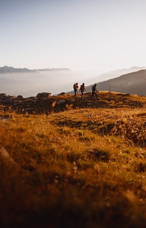
The most beautiful way to visit the mountain lake is as part of a circular hike. Depending on the season, a red carpet of blooming alpine roses welcomes mountaineers to the Wattener Lizum. In addition to the two valleys to be hiked through (Mölstal and Wattental), this circular hike also offers a place of culinary enjoyment with the rustic Lizumer Hütte.
Route description
From the parking lot at the Walchen camp in the Wattental valley, first follow the paved road into the valley. At the end of the barracks area, turn right into the Mölstal valley and follow the Almweg 328. The path is quite steep at the beginning, but later winds its way up more gently. The view of the end of the valley and the steeply sloping flanks of the Seekarspitze, Sunntiger, Malgrübler and Haneburger to the left becomes increasingly picturesque. Passing the Mölser Niederleger, you can already guess the flatter section of the trail, which leads past stone pines to the Mölser Hochleger. It takes about 1 1/2 hours to reach this point.
On the left is a sign at an alpine hut, which shows us the way along a path up to a step in the terrain. A rushing stream accompanies this steep ascent, which takes about 20 minutes. Once at the top, our place of power lies at 2,280 m, nestled between the Mölser Scharte and the surrounding elevations. A truly wonderful place for a rest!
The route then continues uphill to the Mölser Scharte. The view down to Lake Mölssee makes its blue color more and more intense! Once you reach the Mölser Scharte, the broad basin of the Wattener Lizum stretches out before you. You then descend to the Lizumerhütte. If you wish, you can make a detour to the Mölser Berg (2479 m).
The descent from the Lizumerhütte is via the idyllic Zirmweg, which is also one of our places of power. The hike takes around 5 hours in total.
The Mölssee
It is interesting to note that the spelling of this lake is often quite different. Older literature, for example, often uses the term Mölsersee or Mölstalsee. We, on the other hand, always refer to the lake as Mölssee in our documents.
The location of Lake Möls
Lake Mölssee is located in the Mölstal, a side valley of the Wattental. At an altitude of 200 m south-east above the Mölser Hochleger, this wonderful mountain lake is located in a small shallow basin below the Mölserscharte (2379 m) and the Roßkopf (2454 m) at 2238 m above sea level. It has a length of 144 m, a maximum width of 65 m and a surface area of 8430 m2. Its maximum depth is 6.75 m and its volume is 26,450 m3. It never gets warmer than 16 degrees Celcius. The mountain lake is characterized by its drinking water quality and thanks to the crystal-clear water, it is home to numerous species of carp and trout. According to a study and measurement by Father Paul Gutmann, the Mölssee is the most translucent body of water in Austria.
South of the Mölserscharte, a cirque drops steeply down to the lake. The rounded shapes of the rocks clearly indicate that a glacier must have descended from this cirque. The lake can only be reached on foot, but is not always accessible as it lies in a restricted military area.
Historical mentions of Lake Mölsee
Well-known and important figures from history have already reported on Lake Mölssee. For example, the lake is mentioned in the fishing book of Emperor Maximilian I from 1500, where it is referred to as "zwen Wildsee im Tale Mels mit Forchen und Renken".
The town physician Hippolyt Guarinoni from Hall also describes the lake in his 1610 book "Greuel der Verwüstung des menschlichen Geschlechtes" (Abomination of Desolation of the Human Race) as the "Wattensee", which lies in the highest mountains and contains the best char. He visited the lake on a mountain hike from the Voldertal over the Joch into the Wattental. According to legend, his companions tried to cause a thunderstorm by throwing stones into the lake, but without success.
Source: Stolz, Waters of Tyrol, 1936
Legends and stories about Lake Mölssee in the Wattener Lizum
During closer investigations of Lake Mölsee, the inflows and outflows of the water were changed. And this had an impact on the mysterious, legendary tales surrounding the mountain lake.
However, it has long been proven that there are no monsters, underground connections or sinister whirlpools in the lake. Nevertheless, various stories persist, such as that in ancient times a butter churn once fell into the lake and disappeared without a trace. After some time, this wooden churn, which bore a name sign, would have reappeared in Lake Constance. Similarly, a bull that had ventured too far into the lake on a hot day had once sunk without being found and its carcass had also washed up on the shores of Lake Constance.
The legend of the unfathomable Mölssee
The legendary Lake Mölssee was long considered unfathomably deep and was even said to be connected to the Mediterranean via underground channels. As often as there were storms in the Mediterranean, the Mölssee would also roar, even when the weather in the Wadden Valley was calm and beautiful. And if there is an audible noise from its depths, it is said that the lake is barking to announce the approach of a storm.
In the 1958 Wattener Buch, the Tyrolean lawyer and local historian Dr. Alfons Kasseroler dispelled the myth of the unfathomable Mölsee. He reported that the mountain lake had been thoroughly investigated and plumbed - and was only six meters deep at its deepest point.
Source: Mysterious Hall, Christine Zucchelli
Iron mine in the Mölstal on the Wattenberg
North Tyrol's oldest iron mine and the Wattenberg coat of arms
Around 1300, an iron mine was established in the Mölstal valley, whose tunnels reached deep into the massif of the Naviser Sonnenspitze. Incidentally, this is the oldest mine in North Tyrol. The mine in the Mölstal valley was opened in 1315. The mining of iron and copper was quite productive and continued until the 17th century. The reason why the coat of arms of the Wattenberg depicts a student with a book and pen has to do with the iron mine. This was because this newly acquired economic boon enhanced the reputation of the inhabitants, who were able to contribute their mining experience to the silver mining industry in Schwaz, which started later. Education became important and so a paid schoolmaster was sent to Wattenberg in 1524. Wattenberg was therefore the rural community with the oldest village school, which is why the Tyrolean provincial parliament awarded the community this very coat of arms on September 12, 1978.
Gold in the Mölstal valley
It is virtually impossible that major gold deposits were ever mined in the Mölstal or Wattental valleys. However, gold-colored gravels, which may also contain traces of gold and are then referred to as göldische Kiese, were certainly washed out of the streams in the valley. This gold panning from streams and rivers had been common in large parts of Tyrol since the late Middle Ages, but was discontinued in the 17th century. The legends of immense veins of gold between Mölstal and Klammalm lasted much longer.
These legends can be read in Christine Zucchelli's book, Mysterious Hall: "Das Goldbergwerk", "Die Venediger" or "Die Goldlacke".
Source: Christine Zucchelli, Mysterious Hall


