Wurzelschellweg

Hiking route recommended route

Wurzelschellweg

Hiking route · Hall-Wattens
Logo Tourismusverband Region Hall-Wattens
Responsible for this content
Tourismusverband Region Hall-Wattens Verified partner  Explorers Choice 
  • Photo: Hall Wattens, Tourismusverband Region Hall-Wattens
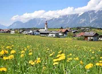
Nice family round to the Wattental
moderate
Distance 6.3 km
2:00 h
357 m
357 m
884 m
567 m
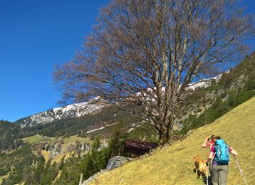
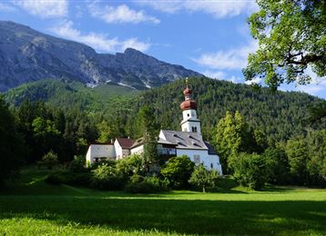
On the Jakob-Gapp-Kreuzweg and the signposted route, you first walk along the medieval Erzsteig steeply uphill to the Keilfeld district on the Wattenberg (30min). Pass the wooden Hisch Chapel and continue to the "Keilhof". There the trail follows the signs "Vögelsberg via Wurzelschell" and descends flat along the road to the Innerachen power station. Here the romantic part leads through forest and meadows to the Vögelsberg inn. The trail leads back to Wattens via the Piepmatzweg.
Profile picture of Anne W.
Author
Anne W. 
Update: July 07, 2023
Difficulty
moderate
Technique
Stamina
Experience
Landscape
Highest point
884 m
Lowest point
567 m
Best time of year
Jan
Feb
Mar
Apr
May
Jun
Jul
Aug
Sep
Oct
Nov
Dec

Track types

Asphalt 13.27%Forested/wild trail 8.10%Path 37.30%Road 21.94%Unknown 19.37%
Asphalt
0.8 km
Forested/wild trail
0.5 km
Path
2.3 km
Road
1.4 km
Unknown
1.2 km
Show elevation profile

Start

Wattens (593 m)
Coordinates:
DD
47.287216, 11.595156
DMS
47°17'14.0"N 11°35'42.6"E
UTM
32T 696233 5240348
w3w 
///microscope.twiddle.blowing

Destination

Wattens

Public transport

Public-transport-friendly

Bus 456

Parking

few parking spaces at the E-Werk Wattens

Coordinates

DD
47.287216, 11.595156
DMS
47°17'14.0"N 11°35'42.6"E
UTM
32T 696233 5240348
w3w 
///microscope.twiddle.blowing
Arrival by train, car, foot or bike

Similar routes nearby

  • Wattens - Kolsass
  • Kleinvolderberg - Volderwildbad
  • Rote Wand
  • To the healing water of the Maria Larch Chapel
  • Waldrunde Wattenberg
 These suggestions were generated by our system
Difficulty
moderate
Distance
6.3 km
Duration
2:00 h
Ascent
357 m
Descent
357 m
Highest point
884 m
Lowest point
567 m
Public-transport-friendly Round trip Refreshment stops available Family-friendly Cultural/historical interest Insider tip

Statistics

  • Content
  • Show images Hide images
Features
Maps and trails
Distance  km
Duration : h
Ascent  m
Descent  m
Highest point  m
Lowest point  m
Push the arrows to change the view

Please wait

Accommodation is searched

Please be patient for a little more time

All data will be loaded in an instant