Hiking

Hard

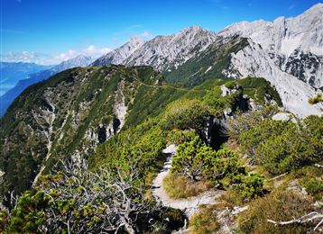
Via Alpina - Red trail - From the Inn Valley south

Long-Distance Hiking

60,05 km

23:15 h

2969 hm

4345 hm

2794 m

Best Time of Year

Jan

Feb

Mar

Apr

May

Jun

Jul

Aug

Sep

Oct

Nov

Dec

Features & Properties

Stamina

Experience

Landscape

Map & Elevation Profile

Similar Tour Suggestions
Milser Skulpturenweg

Easy

Running

Nature Trail

2,14 km

00:30 h

20 hm

652 m

Path of Contemplation

Easy

Running

Nature Trail

3,78 km

01:05 h

130 hm

16 hm

908 m

Stage 6 - Karwendel Höhenweg

Hard

Hiking

Long-Distance Hiking

19,57 km

05:30 h

49 hm

835 hm

1766 m

Varied hike along the Adolf Pichler Trail

Easy

Hiking

Hiking route

11,29 km

03:00 h

360 hm

232 hm

953 m

Zum Alpengasthaus St. Magdalena im Halltal

Easy

Hiking

Hiking route

7,21 km

04:00 h

516 hm

1288 m

Hike to 4 huts - Almenweg 1600

Medium

Hiking

Hiking route

10,41 km

03:10 h

251 hm

656 hm

1959 m

Senselerweg: Von der Voldertalhütte über das Naviser Jöchl zur Zehenter Alm

Medium

Hiking

Wattens - Kolsass

Easy

Hiking

Hiking route

8,64 km

02:30 h

321 hm

331 hm

853 m