We use cookies for your personalized browsing experience, to personalize content and ads, to provide social media features, and to analyze traffic to our website. We also share information about your use of our website with our social media, advertising and analytics partners. Our partners may combine this information with other data that you have provided to them or that they have collected as part of your use of the Services. (incl. US providers)

Medium

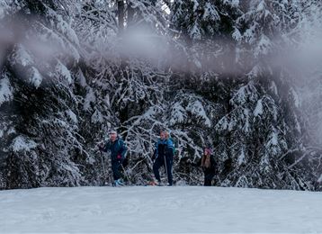
Tulfes-Rinn - Panorama - Loipe 3

Cross-Country Skiing

4,44 km

01:17 h

65 hm

918 m

Best Time of Year

Jan

Feb

Mar

Apr

May

Jun

Jul

Aug

Sep

Oct

Nov

Dec

Information

The more than 4km long track is part of the 27 km long trail network Tulfes- Rinn.

Overall, the Tulfes-Rinn region has five cross-country trails, which have different levels of difficulty.

For further information: Tourismusverband Region Hall - Wattens - Unterer Stadtplatz 19 - 6060 Hall in Tirol

Tel .:

Read More...

Recommended Equipment

Wird verliehen von:

  •     Skiverleih Total Skischule
  •     Schiverleih Schischule Glungezer

Nähere Informationen:

http://www.hall-wattens.at/de/schiverleih.html

Features & Properties

Stamina

Experience

Skill

Landscape

Map & Elevation Profile

Arrival

Aus Deutschland: Grenzübergang Kiefersfelden - Kufstein - ca. 70 km nach Hall über Autobahn A 12 - Ausfahrt Hall Mitte - Bundesstraße (B171) bis Tulfes

Aus Italien: Grenzübergang Brenner nach Innsbruck - bis Hall 10 km -> Ausfahrt Hall Mitte- Bundesstraße(B171) bis Tulfes

Aus der Schweiz: Landeck - Autobahn bis Hall ca.

Read More...

Similar Tour Suggestions

Largoz – a short ski tour suitable for every winter

Medium

To the little alp village

Medium

Snowshoe walking

8,42 km

03:00 h

574 hm

1930 m

Snowshoeing from Wattens to Gasthof Vögelsberg

Easy

Snowshoe walking

3,56 km

01:30 h

294 hm

284 hm

861 m

Loipe Tulfes Rinn - Panorama-Loipe 1

Easy

Cross-Country Skiing

4,65 km

01:10 h

86 hm

920 m

Winterrunde Wattens - Kolsass

Medium

Winter Hiking

8,67 km

02:30 h

363 hm

368 hm

825 m

Loipe Gnadenwald

Easy

Cross-Country Skiing

15,74 km

02:00 h

267 hm

264 hm

877 m

Winterwanderung Speckbacherweg

Easy

Winter Hiking

16,42 km

04:35 h

349 hm

344 hm

1023 m

Tobboganing Kreuztaxen

Medium

Sledding

2,99 km

00:50 h

344 hm

1616 m