To the little alp village

Snowshoe walking recommended route

To the little alp village

Snowshoe walking · Hall-Wattens
Logo Tourismusverband Region Hall-Wattens
Responsible for this content
Tourismusverband Region Hall-Wattens Verified partner  Explorers Choice 
  • Largozalm
    Largozalm
    Photo: Anne W., Tourismusverband Region Hall-Wattens

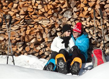
Snowshoeing with gigantic views to the Karwendel and the Inntal


moderate
Distance 8.4 km
3:00 h
574 m
574 m
1,930 m
1,362 m

Author’s recommendation

Die Jause nicht vergessen!

Profile picture of Anne W.
Author
Anne W. 
Update: February 13, 2023
Difficulty
moderate
Stamina
Experience
Landscape
Highest point
1,930 m
Lowest point
1,362 m
Best time of year
Jan
Feb
Mar
Apr
May
Jun
Jul
Aug
Sep
Oct
Nov
Dec

Track types

Dirt road 79.46%Forested/wild trail 15.06%Path 5.47%
Dirt road
6.7 km
Forested/wild trail
1.3 km
Path
0.5 km
Show elevation profile

Start

Krepperhütte (1,366 m)
Coordinates:
DD
47.256740, 11.573861
DMS
47°15'24.3"N 11°34'25.9"E
UTM
32T 694735 5236908
w3w 
///unbearable.cherished.implicit

Destination

Krepperhütte

Turn-by-turn directions

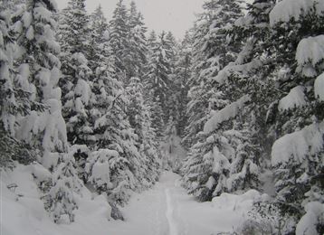
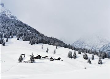
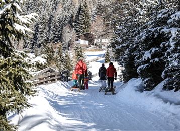
We start at the parking space near the Krepperhütte with our snowshoes along the track to Largoz. After one and a half hour you reach the goal, the little alp village. If the weather conditions are good, the view will make you breathless.


Coordinates

DD
47.256740, 11.573861
DMS
47°15'24.3"N 11°34'25.9"E
UTM
32T 694735 5236908
w3w 
///unbearable.cherished.implicit
Arrival by train, car, foot or bike

Similar routes nearby

  • Tulfer Waldweg "Schöne Aussicht"
  • Snowshoeing from Wattens to Gasthof Vögelsberg
  • Snowshoeing up to the Glungezerhut
  • Snowshoe- Hike from the Glungezer to the Patscherkofel
  • With snowshoes from the Glungezer to the Kreuzspitze
 These suggestions were generated by our system
Difficulty
moderate
Distance
8.4 km
Duration
3:00 h
Ascent
574 m
Descent
574 m
Highest point
1,930 m
Lowest point
1,362 m
Scenic Insider tip Forest roads Forest

Statistics

  • Content
  • Show images Hide images
Features
Maps and trails
Distance  km
Duration : h
Ascent  m
Descent  m
Highest point  m
Lowest point  m
Push the arrows to change the view

Please wait

Accommodation is searched

Please be patient for a little more time

All data will be loaded in an instant