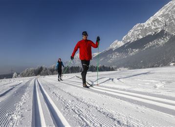
The multi-faceted Glungezer

Ski Touring recommended route

The multi-faceted Glungezer

Ski Touring · Hall-Wattens
Logo Tourismusverband Region Hall-Wattens
Responsible for this content
Tourismusverband Region Hall-Wattens Verified partner  Explorers Choice 
  • Im Aufstieg
    Im Aufstieg
    Photo: Hall Wattens, Tourismusverband Region Hall-Wattens

The multi-faceted Glungezer via the "norma track" from Tulfes

moderate
Distance 3.1 km
1:22 h
741 m
128 m
2,668 m
2,055 m
There is no other mountain in the area which offers you so many different ways to go up and have a good run down!


Profile picture of Hall Wattens
Author
Hall Wattens
Update: May 02, 2023
Difficulty
moderate
Stamina
Experience
Landscape
Highest point
2,668 m
Lowest point
2,055 m
Best time of year
Jan
Feb
Mar
Apr
May
Jun
Jul
Aug
Sep
Oct
Nov
Dec

Track types

Show elevation profile

Rest stops

Glungezer-Hut

Start

Coordinates:
DD
47.226053, 11.529730
DMS
47°13'33.8"N 11°31'47.0"E
UTM
32T 691506 5233389
w3w 
///nasality.reintroduce.relax

Turn-by-turn directions

Depending on your state of health and the snow the starting point for the skitour up to the Glungezer range between Hall and Volders.

Starting in Hall you start near the Hotel Badl through the Hasental - 2.100m to get up to the peak of the Glungezer.

For a "normal" skitour the starting point is at the mountain station of the cable car following the pist to the Tulfein Alm at 2.035m.

Furtheron at the pist to the saddle of the Schartenkogel (2.230m) and right hand side, direction south, to the peak.


Public transport

Public-transport-friendly

Bus 4134 to Tulfes

By road

Hall - Tulfes

Parking

At the Cable Car station

Coordinates

DD
47.226053, 11.529730
DMS
47°13'33.8"N 11°31'47.0"E
UTM
32T 691506 5233389
w3w 
///nasality.reintroduce.relax
Arrival by train, car, foot or bike

Similar routes nearby

  • Largoz – a short ski tour suitable for every winter
  • Ski Touring - Hirzer - Wattental Valley
  • Die längste Skitour Tirols: Von der Karlskirche zum Glungezergipfel
  • Skitour auf die Grafenspitze
  • The Geier
 These suggestions were created automatically.
Difficulty
moderate
Distance
3.1 km
Duration
1:22 h
Ascent
741 m
Descent
128 m
Highest point
2,668 m
Lowest point
2,055 m
Public-transport-friendly Scenic Refreshment stops available Cableway ascent/descent Summit route

Statistics

  • Content
  • Show images Hide images
Features
Maps and trails
  • 2 Waypoints
  • 2 Waypoints
Distance  km
Duration : h
Ascent  m
Descent  m
Highest point  m
Lowest point  m
Push the arrows to change the view

Please wait

Accommodation is searched

Please be patient for a little more time

All data will be loaded in an instant