Ski Touring - Hirzer - Wattental Valley

Ski Touring recommended route

Ski Touring - Hirzer - Wattental Valley

Ski Touring · Hall-Wattens
Logo Tourismusverband Region Hall-Wattens
Responsible for this content
Tourismusverband Region Hall-Wattens Verified partner  Explorers Choice 
  • Photo: Thomas Geisler, CC BY, Thomas Geisler

Up the 2,725-m high Hirzer - Wattental

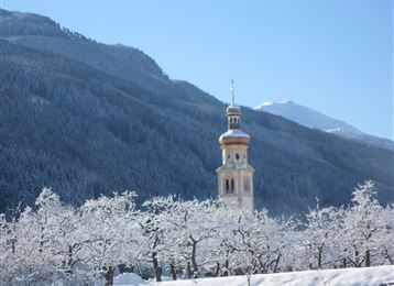
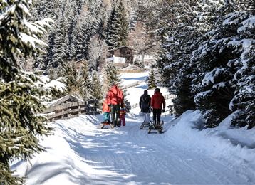
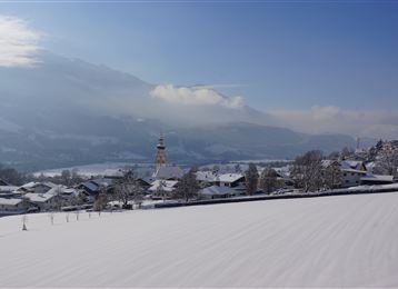
A popular tour in the Watten valley - first woodland, later flattish mountain pasture and then higher up stunning ski slopes form the main features of this tour. Usually tracked, as very popular with the locals, the Hirzer is not a particularly difficult tour - but an elevation gain of 1,370m should not be taken lightly.

moderate
Distance 6.8 km
4:00 h
1,361 m
2 m
2,712 m
1,351 m
Profile picture of Hall Wattens
Author
Hall Wattens
Update: April 06, 2021
Difficulty
moderate
Technique
Stamina
Experience
Landscape
Highest point
2,712 m
Lowest point
1,351 m
Best time of year
Jan
Feb
Mar
Apr
May
Jun
Jul
Aug
Sep
Oct
Nov
Dec

Track types

Asphalt 51.67%Forested/wild trail 0.93%Path 4.43%Unknown 42.95%
Asphalt
3.5 km
Forested/wild trail
0.1 km
Path
0.3 km
Unknown
2.9 km
Show elevation profile

Safety information

Sie durchqueren das Gebiet eines Truppenübungsplatzes. Die Strecken können zeitweise gesperrt sein.

Tips and hints

This route crosses a military training ground. Some parts of the route may be closed at certain times.

Start

Gasthof Hanneburger - Wattenberg (1,352 m)
Coordinates:
DD
47.223444, 11.616767
DMS
47°13'24.4"N 11°37'00.4"E
UTM
32T 698105 5233316
w3w 
///prompted.examinations.reviewers

Destination

Gasthof Hanneburger - Wattenberg

Turn-by-turn directions

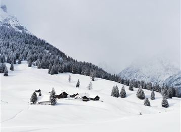
Start out at a mountain bar and finish at a mountain bar … that may stir up of malicious rumours about the purpose of the tour, but it would be unworthy to think such thoughts about the Hirzer. The tour stars with a gentle climb just north of the car-park and then winds its way up to the open pastures of the Pofersalm (1,600m). 

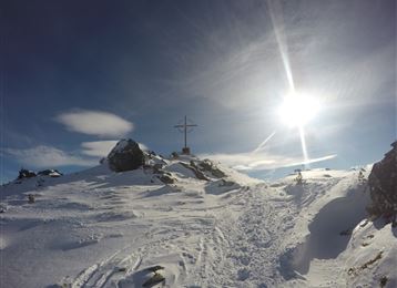
In some places it is possible to take a short cut through the forest, but the steep incline and the dense woodland reduce any time savings and use up energy unnecessarily. Following the open pastures to the east, the track branches off to the south east just below the Pofersalm, passing a small mountain pasture hut and then continues on through a wide clearing and less compact stone pine forest as far as the Poferer Hochleger (upper pasture). Continuing mainly in an easterly direction through perfect skiing terrain, you gain height, then follow the north-west ridge running from the Sagspitze as far as a secondary peak. Remove your skis and cover the last few metres to the summit on foot.

Downhill same as ascent.

By road

Mit dem PKW ist die Anreise am besten über die Inntalautobahn A12  und die Ausfahrt 61-Wattens möglich - weiter auf der L339/Wattenbergbis Sie Ihr Ziel erreichen.

Parking

Beim Gasthof Hanneburger gibt es Parkmöglichkeiten.

Coordinates

DD
47.223444, 11.616767
DMS
47°13'24.4"N 11°37'00.4"E
UTM
32T 698105 5233316
w3w 
///prompted.examinations.reviewers
Arrival by train, car, foot or bike

Similar routes nearby

  • Skitour auf die Grafenspitze
  • Largoz – a short ski tour suitable for every winter
  • The Geier
  • The multi-faceted Glungezer
  • Die längste Skitour Tirols: Von der Karlskirche zum Glungezergipfel
 These suggestions were generated by our system
Difficulty
moderate
Distance
6.8 km
Duration
4:00 h
Ascent
1,361 m
Descent
2 m
Highest point
2,712 m
Lowest point
1,351 m

Statistics

  • Content
  • Show images Hide images
Features
Maps and trails
Distance  km
Duration : h
Ascent  m
Descent  m
Highest point  m
Lowest point  m
Push the arrows to change the view

Please wait

Accommodation is searched

Please be patient for a little more time

All data will be loaded in an instant