Largoz – a short ski tour suitable for every winter

Ski Touring recommended route

Largoz – a short ski tour suitable for every winter

Ski Touring · Hall-Wattens
Logo Tourismusverband Region Hall-Wattens
Responsible for this content
Tourismusverband Region Hall-Wattens Verified partner  Explorers Choice 
  • kurz vor dem Gipfel
    kurz vor dem Gipfel
    Photo: Anne W., Tourismusverband Region Hall-Wattens
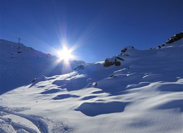
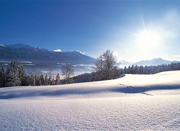
Idyllic slopes and woodland descents. If after a fresh snowfall you want to be the first to leave your mark on the Largoz, the peak fronting the mountain range between the Volders and Wattens valleys, then you will have to make an early start.
moderate
Distance 3.5 km
3:00 h
854 m
3 m
2,212 m
1,361 m
Idyllic slopes and woodland descentsIf after a fresh snowfall you want to be the first to leave your mark on the Largoz, the peak fronting the mountain range between the Volders and Wattens valleys, then you will have to make an early start. Because firstly the 2,214-m high Largoz is one of the most popular, but also a relatively safe ski touring destination and secondly a popular choice for training tours.

Author’s recommendation

Sonnenverwöhnte Hänge bis spät in den Nachmittag hinein!
Profile picture of Hall Wattens
Author
Hall Wattens
Update: November 26, 2019
Difficulty
moderate
Technique
Stamina
Experience
Landscape
Highest point
2,212 m
Lowest point
1,361 m
Best time of year
Jan
Feb
Mar
Apr
May
Jun
Jul
Aug
Sep
Oct
Nov
Dec

Track types

Show elevation profile

Rest stops

Alpenrelax Krepperhütte

Tips and hints

http://www.hall-wattens.at/


Start

Parkplätze der Krepperhütte (1,360 m)
Coordinates:
DD
47.256663, 11.573549
DMS
47°15'24.0"N 11°34'24.8"E
UTM
32T 694711 5236899
w3w 
///consolation.tuxedos.hummed

Destination

Parkplätze der Krepperhütte

Turn-by-turn directions

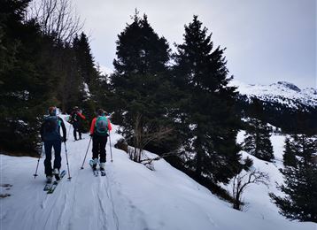
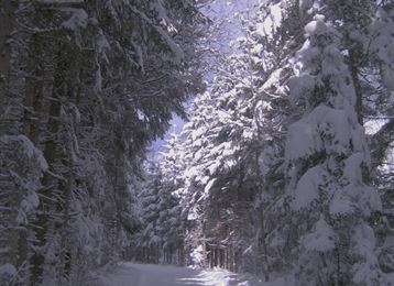
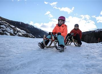
This tour, which starts above the Krepperhütte at approx. 1,400m, quickly requires a decision: If you wish, you can follow the toboggan path on the right side or the downhill on the left side - but for the best encounter with the natural world, the middle path, which winds its way up through the forest, is surely the best option. When there's been fresh fall of snow, the ascent into this idyllic snowscape is a pure delight. The trail crosses the forest track a number of times, before the open mountain pasture starts just beneath the Largozalm. Enjoy the first view over the Inn valley from this idyllic mountainside village at 1,963m, but then keep right on a wide ridge. The track leads to the summit in a south-easterly direction through troughs and via some short, steep sections. For the descent: the gentle slopes down to the Largozalm are great fun. From here, only good skiers should venture off the forest trail that winds down the mountainside.

This tour can be extended in many ways - from Volders the elevation gain is approx. 1,600m.

By road

Aus Richtung Deutschland: Grenzübergang Kiefersfelden - Kufstein - ca. 70 km nach Hall über Autobahn A 12 - Die Ausfahrt 61-Wattens nehmen -  abbiegen auf Großvolderbergstr./L371 - der Beschilderung Richtung Krepperhütte folgen

Aus Richtung Italien: Grenzübergang Brenner nach Innsbruck - bis Hall 10 km -> Die Ausfahrt 61-Wattens nehmen -  abbiegen auf Großvolderbergstr./L371 - der Beschilderung Richtung Krepperhütte folgen

Aus der Schweiz: Landeck - Autobahn bis Hall ca. 80 km -> Die Ausfahrt 61-Wattens nehmen -  abbiegen auf Großvolderbergstr./L371 - der Beschilderung Richtung Krepperhütte folgen

Parking

Parkplätze unterhalb und oberhalb der Krepperhütte

Coordinates

DD
47.256663, 11.573549
DMS
47°15'24.0"N 11°34'24.8"E
UTM
32T 694711 5236899
w3w 
///consolation.tuxedos.hummed
Arrival by train, car, foot or bike

Similar routes nearby

  • Die längste Skitour Tirols: Von der Karlskirche zum Glungezergipfel
  • The multi-faceted Glungezer
  • Ski Touring - Hirzer - Wattental Valley
  • Skitour auf die Grafenspitze
  • The Geier
 These suggestions were generated by our system
Difficulty
moderate
Distance
3.5 km
Duration
3:00 h
Ascent
854 m
Descent
3 m
Highest point
2,212 m
Lowest point
1,361 m
Scenic Refreshment stops available Summit route Forest roads Clear area Forest

Statistics

  • Content
  • Show images Hide images
Features
Maps and trails
  • 1 Waypoints
  • 1 Waypoints
Distance  km
Duration : h
Ascent  m
Descent  m
Highest point  m
Lowest point  m
Push the arrows to change the view

Please wait

Accommodation is searched

Please be patient for a little more time

All data will be loaded in an instant