Inntal circle

Nordic Walking recommended route

Inntal circle

Nordic Walking · Hall-Wattens
Logo Tourismusverband Region Hall-Wattens
Responsible for this content
Tourismusverband Region Hall-Wattens Verified partner  Explorers Choice 
  • Im Inntal
    Im Inntal
    Photo: Hall Wattens, Tourismusverband Region Hall-Wattens
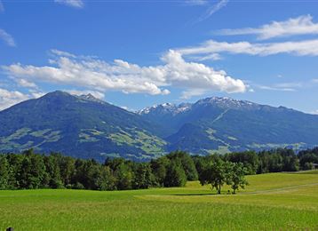
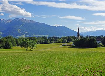
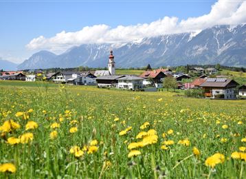
An ideal route for beginners, heading over fields to Volders and back again to Wattens
easy
Distance 4.2 km
1:02 h
6 m
6 m
553 m
547 m
Over fields back to Volders and back again to Wattens.
Profile picture of Hall Wattens
Author
Hall Wattens
Update: July 07, 2023
Difficulty
easy
Stamina
Experience
Landscape
Highest point
553 m
Lowest point
547 m
Best time of year
Jan
Feb
Mar
Apr
May
Jun
Jul
Aug
Sep
Oct
Nov
Dec

Track types

Show elevation profile

Tips and hints

http://www.hall-wattens.at/

Start

Wattens Schwimmbad (548 m)
Coordinates:
DD
47.294070, 11.580000
DMS
47°17'38.7"N 11°34'48.0"E
UTM
32T 695062 5241072
w3w 
///pencils.saddens.remarry

Destination

Wattens Schwimmbad

Turn-by-turn directions

Starting off at the car park of the swimming baths, the route heads west across the fields to Volders. On the outskirts of Volders, the circuit heads on the Inn side back to Wattens and finally back to the starting point.

Public transport

Es besteht die Möglichkeit das Stadtzentrum von Wattens mit der "Linie 456" von Hall i. T. bzw. Innsbruck zu erreichen.

Von dort sind es circa 15 Gehminuten bis zum Ausgangspunkt.

Nähere Informationen unter:

www.vvt.at

By road

Aus Deutschland: Grenzübergang Kiefersfelden - Kufstein - - ca. 65 km nach Wattens über Autobahn A 12 - Ausfahrt 61-Wattens - Im Kreisverkehr erste Ausfahrt nehmen - Rechts abbiegen auf Doktor. Karl-Stainer Straße

Aus Italien: Grenzübergang Brenner nach Innsbruck - ca. 20 km nach Wattens über Autobahn A 12 - Ausfahrt 61-Wattens - Im Kreisverkehr erste Ausfahrt nehmen - Rechts abbiegen auf Doktor Karl-Stainer Straße

Aus der Schweiz : Landeck - Autobahn bis Hall ca. 90 km -> Ausfahrt 61-Wattens - Im Kreisverkehr erste Ausfahrt nehmen - Rechts abbiegen auf Doktor Karl-Stainer Straße

Parking

Direkt beim Startpunkt befinden sich Parkmöglichkeiten.

Coordinates

DD
47.294070, 11.580000
DMS
47°17'38.7"N 11°34'48.0"E
UTM
32T 695062 5241072
w3w 
///pencils.saddens.remarry
Arrival by train, car, foot or bike

Similar routes nearby

  • Lourdes Chapel Run
  • Historic Circuit
  • Haslach circuit
  • Weissenbach circuit
  • Baumkirchner forest circuit
 These suggestions were generated by our system
Difficulty
easy
Distance
4.2 km
Duration
1:02 h
Ascent
6 m
Descent
6 m
Highest point
553 m
Lowest point
547 m
Round trip

Statistics

  • Content
  • Show images Hide images
Features
Maps and trails
Distance  km
Duration : h
Ascent  m
Descent  m
Highest point  m
Lowest point  m
Push the arrows to change the view

Please wait

Accommodation is searched

Please be patient for a little more time

All data will be loaded in an instant