Illuminated natural tobbogan run at Vögelsberg

Sledding recommended route

Illuminated natural tobbogan run at Vögelsberg

Sledding · Hall-Wattens
Logo Tourismusverband Region Hall-Wattens
Responsible for this content
Tourismusverband Region Hall-Wattens Verified partner  Explorers Choice 
  • Tobogganing
    Tobogganing
    Photo: Hall Wattens, Tourismusverband Region Hall-Wattens
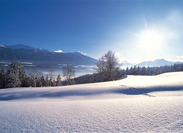
A toboggan run in the nocturnal winter landscape - a dream in the cold season made possible by the illuminated toboggan run on the Vögelsberg
easy
Distance 1.8 km
0:50 h
240 m
14 m
871 m
632 m
This toboggan run is ideal for young and old. In the evening it is even illuminated until 23 o'clock.

Author’s recommendation

Night tobogganing with a stop at Gasthaus Vögelsberg!
Profile picture of Hall Wattens
Author
Hall Wattens
Update: July 07, 2023
Difficulty
easy
Stamina
Experience
Landscape
Highest point
871 m
Lowest point
632 m
Best time of year
Jan
Feb
Mar
Apr
May
Jun
Jul
Aug
Sep
Oct
Nov
Dec

Track types

Asphalt 8.25%Path 56.66%Road 34.84%Unknown 0.23%
Asphalt
0.1 km
Path
1 km
Road
0.6 km
Unknown
0 km
Show elevation profile

Start

E-Werk in Wattens/ Swarovski-Werk 2 - Wattens (645 m)
Coordinates:
DD
47.286222, 11.588219
DMS
47°17'10.4"N 11°35'17.6"E
UTM
32T 695712 5240220
w3w 
///magnitudes.energies.closing

Destination

Gasthof Vögelsberg

Turn-by-turn directions

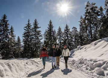
Of course, the well-prepared toboggan run with its varied passages is a pleasure even when the winter sun is laughing from the blue sky. For all night tobogganists, it is lit up to 23 hours when there is enough snow.

The ascent takes about 50 minutes and is signposted directly on the toboggan run. It starts at the E-Werk in Wattens.

The descent presents no major problems for experienced tobogganists - but it is not recommended for beginners; there is a short, very steep slope in the upper third of the run.

Public transport

Public-transport-friendly

By bus 4123 to Wattens

www.vvt.at

By road

Wattens - E- Werk Wattens

Parking

You will find parking facilities directly at the E-Werk in Wattens.

Coordinates

DD
47.286222, 11.588219
DMS
47°17'10.4"N 11°35'17.6"E
UTM
32T 695712 5240220
w3w 
///magnitudes.energies.closing
Arrival by train, car, foot or bike

Similar routes nearby

  • Tobboganing Kreuztaxen
  • Tobboganing Volderberg
  • A toboggan run suitable for families to the Hinterhornalm
  • Tobboganing in the Halltal
  • Tobboganing at Runstboden
  • Rodelbahn am Glungezer
  • Tobogganing in the Mölstal/Wattenberg
 These suggestions were generated by our system
Difficulty
easy
Distance
1.8 km
Duration
0:50 h
Ascent
240 m
Descent
14 m
Highest point
871 m
Lowest point
632 m
Public-transport-friendly Scenic Family-friendly Refreshment stops available Floodlight

Statistics

  • Content
  • Show images Hide images
Features
Maps and trails
Distance  km
Duration : h
Ascent  m
Descent  m
Highest point  m
Lowest point  m
Push the arrows to change the view

Please wait

Accommodation is searched

Please be patient for a little more time

All data will be loaded in an instant