The Stone Pine Path

Hiking route recommended route

The Stone Pine Path

Hiking route · Hall-Wattens
Logo Tourismusverband Region Hall-Wattens
Responsible for this content
Tourismusverband Region Hall-Wattens Verified partner  Explorers Choice 
  • Photo: Tirol Werbung/ Sebastian Schels, Tirol Werbung/ Sebastian Schels
Starting at the Patscherkofel over to Tulfes
easy
Distance 7.3 km
2:30 h
89 m
178 m
2,061 m
1,964 m

Famous, popular, much-travelled and yet every time an uplifting experience! The Stone Pine Path above Innsbruck runs from the Patscherkofel mountain station to the Tulfeinalm. (cable car station Glungezerbahn)

Author’s recommendation

Buy the Stone Pine Path circular walk ticket, including bus fares and lift charges.
Profile picture of Hall Wattens
Author
Hall Wattens
Update: February 07, 2024
Difficulty
easy
Technique
Stamina
Experience
Landscape
Highest point
2,061 m
Lowest point
1,964 m
Best time of year
Jan
Feb
Mar
Apr
May
Jun
Jul
Aug
Sep
Oct
Nov
Dec

Track types

Dirt road 0.45%Forested/wild trail 5.44%Path 94.10%
Dirt road
0 km
Forested/wild trail
0.4 km
Path
6.9 km
Show elevation profile

Rest stops

Tulfeinalm
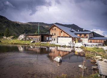
Almgasthaus Boscheben

Tips and hints


Start

Patscherkofel
Coordinates:
DD
47.223423, 11.527682
DMS
47°13'24.3"N 11°31'39.7"E
UTM
32T 691361 5233092
w3w 
///rooming.lurk.spelling

Destination

Tulfes

Turn-by-turn directions

Famous, popular, much-travelled and yet every time an uplifting experience!

The Stone Pine Path above Innsbruck runs from the Patscherkofel mountain station to the Tulfeinalm.

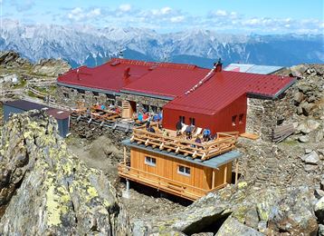
Catch the bus from Tulfes to the Patscherkofel station in Igls and then take the gondola up to a height of 1,964m. At the Schutzhaus Patscherkofel starts the footpath to the east, the so called Stone Pine Path, and also the Alpine Club's Patscherkofel Nature Trail (Naturlehrpfad). Europe's highest botanical garden, where there are more than 400 different high-alpine plants on display.

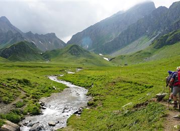
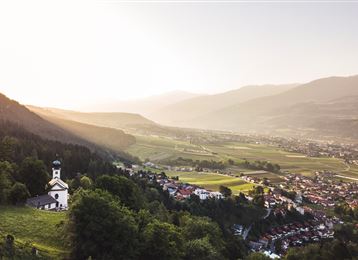
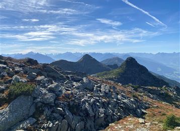
The Stone Pine Path follows a wide mountain path to the Boscheben hut. The gently undulating path; without any major height differences – runs at the tree line at 2,000m above sea level as far as the Tulfeinalm. Throughout the whole walk, there is a fine view over the Inn valley against the stunning backdrop of the Karwendel range opposite. Finally take the Glungezer lift from near the Tulfeinalm down to Tulfes.

Public transport

Public-transport-friendly

Buses from Igls and Tulfes

Parking

Glungezerbahn

Coordinates

DD
47.223423, 11.527682
DMS
47°13'24.3"N 11°31'39.7"E
UTM
32T 691361 5233092
w3w 
///rooming.lurk.spelling
Get there by train, car, bike, or on foot!

Similar routes nearby

  • Die Neunerspitz` Runde
  • Von der Tulfeinalm auf den Schartenkogel
  • Viggarspitze
  • Panoramic Tour Bärenbader Jöchl
  • Haneburger
 These suggestions were generated by our system
Difficulty
easy
Distance
7.3 km
Duration
2:30 h
Ascent
89 m
Descent
178 m
Highest point
2,061 m
Lowest point
1,964 m
Public-transport-friendly Scenic Refreshment stops available Family-friendly Flora Cableway ascent/descent

Statistics

  • Content
  • Show images Hide images
Features
Maps and trails
  • 3 Waypoints
  • 3 Waypoints
Distance  km
Duration : h
Ascent  m
Descent  m
Highest point  m
Lowest point  m
Push the arrows to change the view

Please wait

Accommodation is searched

Please be patient for a little more time

All data will be loaded in an instant